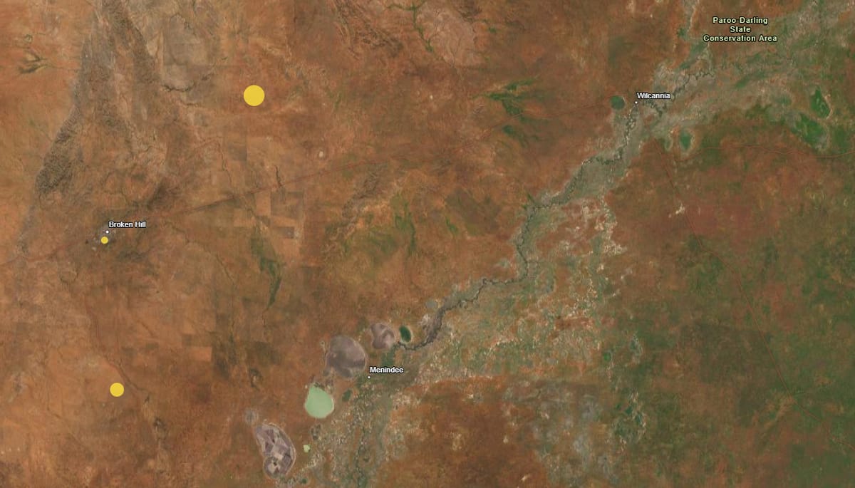
Three earthquakes in less than 30 hours struck the Back Country late last week. The rumbles began with a 2.6-magnitude quake, which struck just before midnight on Friday January 3. This was followed by a followed by a larger 4.1-magnitude quake at 2.50pm on Saturday afternoon and a 3.3-magnitude tremor at 5.30am Sunday morning.
The first quake was located very close to the outback city of Broken Hill, with the next two measured further east, towards Menindee and Wilcannia. It was recorded at a depth of three kilometres underground, while the next two, while larger in magnitude, were 10 kilometres below the surface.
Geoscience Australia senior seismologist Phil Cummins told the ABC there is no reason to believe the three quakes are related, but the service will continue to monitor the region.
More detailed scientific monitoring will be required to understand what caused the events.
What causes earthquakes in Australia?
Australia experiences earthquakes because of its geological position and the movement of the Australian tectonic plate:
- Tectonic plate movement
The Australian plate is the fastest moving continental land mass on Earth, moving northeast at about 7 centimetres per year. It’s colliding with the Pacific plate to the north and east, and the Eurasian plate to the northwest. This collision generates compressive stress in the Australian continent, which builds up over time. When rocks deep underground break and move along a fault line, this stress is suddenly released, causing an earthquake.
- Intraplate earthquakes
Australia is located in the centre of a tectonic plate, so earthquakes are less common than in other places where plates meet. These earthquakes are called intraplate earthquakes, and they’re generally less predictable than earthquakes that occur at plate boundaries.
- Old fault lines
Australia is an ancient continent with old fault lines that can cause earthquakes.
Australia experiences about 80 earthquakes of magnitude 3 or larger each year, but most are small. The largest recorded earthquake in Australia was in 1988, when a magnitude 6.6 earthquake struck Tennant Creek.
Ongoing research
In December, Geoscience Australia released the first update to the National Seismic Hazard Assessment since 2018, identifying Darwin and the eastern highlands through into Latrobe Valley as areas where there is a higher risk of strong ground shaking.
The National Seismic Hazard Assessment defines the level of earthquake ground shaking across Australia that has a given chance of being exceeded in a specific time period. Knowing how the ground shaking hazard varies across Australia allows emergency managers, government agencies and the engineering sector to prepare for, and respond to, earthquakes in Australia.
Senior Seismologist Dr Trevor Allen said the new assessment is based on updated data, models, and insights, collected from field surveys and earthquake catalogues, as well as from people who have felt an earthquake.
This article appeared on Back Country Bulletin on 6 January 2025.
