Sarah Herrmann, Yorke Peninsula Country Times
Damage at Cape Elizabeth was the single biggest driving force behind a proposed coastal access strategy for Yorke Peninsula, Northern and Yorke Landscape Board general manager Tony Fox says. Mr Fox was present at Yorke Peninsula Council’s monthly meeting on February 12.
Councillor Roger Johns had earlier told Mr Fox he was concerned about the environmental degradation occurring at his regular swimming spot at Cape Elizabeth, south of Moonta.
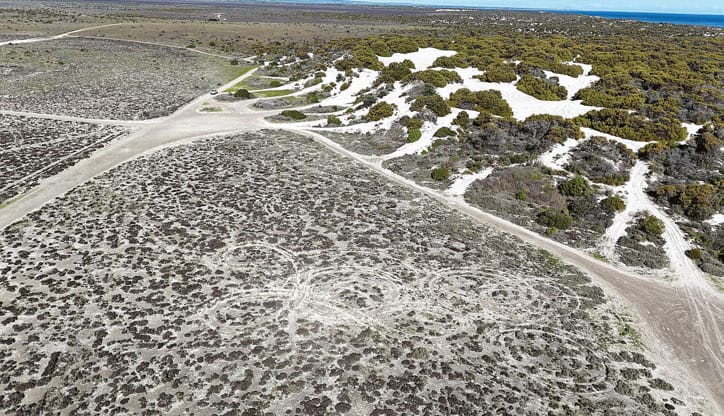
“My observation is that area is continuing to be absolutely trashed,” Cr Johns said.
“There’s new tracks, sand dunes being split in two, vegetation destroyed, a beautiful area for birdlife which has been impacted on — can you give me some assurance that you’re able to be involved or guide or provide some support for these problems?”
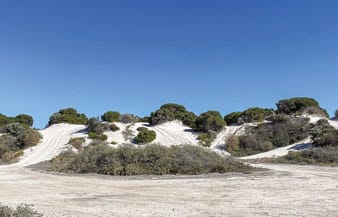
Mr Fox said the Department for Environment and Water managed the Crown section of Cape Elizabeth, and it had installed cameras and signage, and handed out expiation notices.
“The landscape board doesn’t actually manage any coastline; we don’t have any authority under the Crown Lands Act,” he said.
“What we’re looking for from the strategy is a united front from councils, Narungga Nations, Point Pearce Aboriginal Corporation, Aboriginal Lands Trust, the department and the board to really drive some change in that space.
“We really want to make a difference there.
“Specifically, that’s the area we want to stop access to the dunes by four-wheel drives.
“We believe that is an essential pillar of this whole strategy.”
This article appeared in the Yorke Peninsula Country Times, 25 February 2025.
Related story: Coastal plan out now
