Ian Hutton, The Lord Howe Island Signal
In May 2022 the Geological Survey of NSW published an updated geology map for Lord Howe Island. This has been a major revision of the original map published over 30 years ago.
The new map has more detailed geological units – in both the volcanic and sedimentary deposits; and more accurate boundaries of the units.

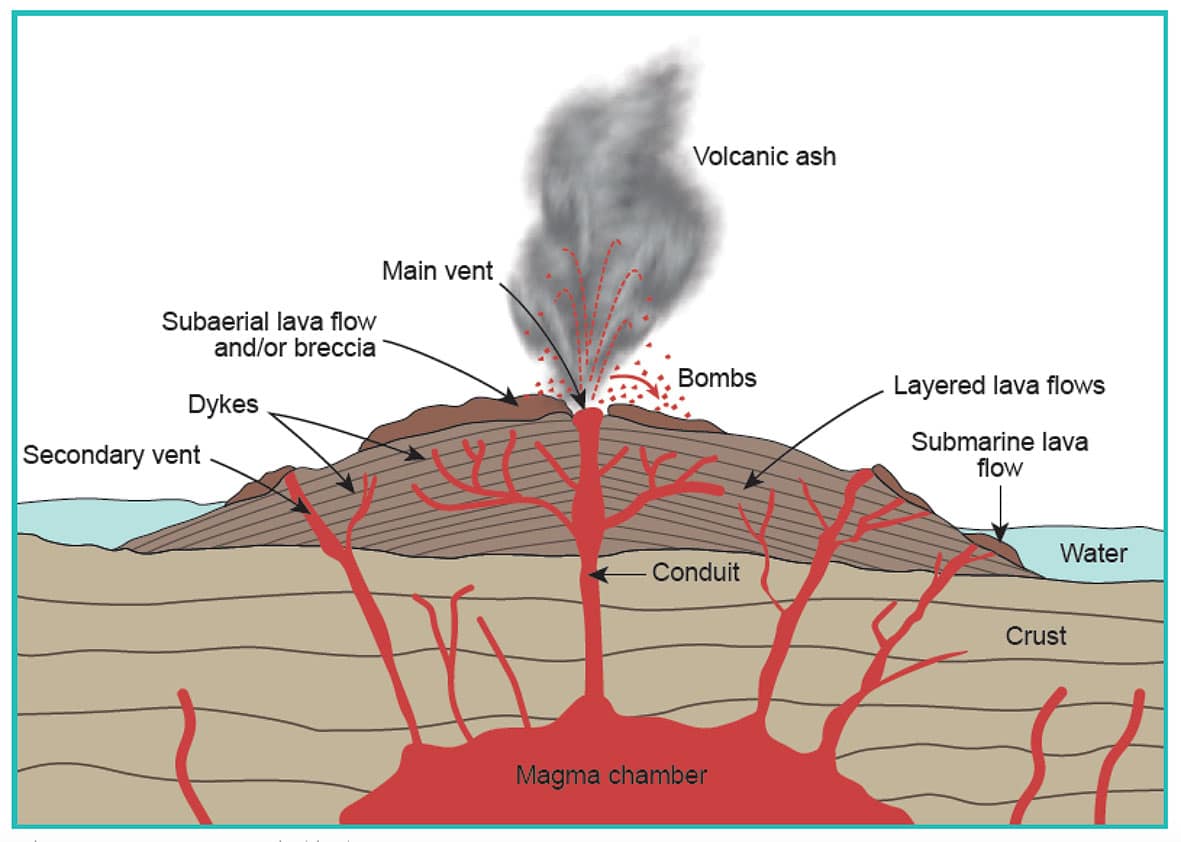
On the reverse side, the map also has detailed text and photos explaining the constructive geological process that formed the Island, and the destructive erosion that has shaped the Island as we see it today.
The museum has the maps available in the shop for $11 each.
This article appeared in The Lord Howe Island Signal, 30 June 2022.
