
… and opportunities to improve fuel management
John O’Donnell
The NSW Rural Fire Service 2023/2024 Annual Report is now on the web.
Hazard reduction burning and mechanical removal totalled 139,927 hectares for NSW (Appendix pages 98 and 99):
- 126,087 ha burning;
- 13,840 ha mechanical;
- Total 139,927 hectares
There is a difference in the terminology used; some use ‘hazard reduction burning’, others use ‘prescribed burning’ or ‘controlled burning’. Another term used is ‘ecological maintenance burning’. And of course, there is ‘cultural burning’.
Unfortunately, areas of annual hazard reduction burning and mechanical reduction in NSW are both at very low rates and vary by year. The areas of fuel reduction in NSW and estimated percentage of forested area based on 20 million hectares of forest in NSW were:
- 147,625 hectares in 2017/18 (estimated 0.7 per cent of NSW forested area);
- 199,248 hectares in 2018/19 (estimated 1.0 per cent of NSW forested area);
- 55,548 hectares in 2019/20 (estimated 0.3 per cent of NSW forested area);
- 176,499 hectares in 2020/21 (estimated 0.9 per cent of NSW forested area) and
- 44,642 hectares in 2021/22 (estimated 0.2 per cent of NSW forested area).
- 90,089 hectares in 2022/23 (estimated 0.5 per cent (actually 0.045 per cent) of NSW forested area).
- 139,927 hectares in 2023/24 (estimated 0.7 per cent of NSW forested area).
Over time, shortfalls and inadequate fuel reduction add up and result in build-up of very high fuel loads and strata across landscapes. Only 4.3 per cent of the NSW forested landscape has received fuel treatment over the last seven years, this is extremely low and inadequate to reduce bushfire areas and risks to communities, firefighters, ecosystems, threatened species, protected areas and sites heritage sites. This seven year outcome represents an average of 0.6 per cent of forests treated per year.
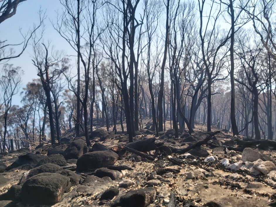
In addition, many of the forests with extensive hot intense bushfires of 2019/20 have high fuel loads and are now five years old. In many cases there are extensive areas of dead trees, heavy grass/ bark fuel and dense understories, all contributing to a potential timebomb in many bushfire seasons.
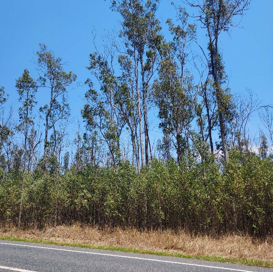
Bushfires have already occurred in these new fuels, one was described along the lines of a knife through butter, another was described as moving quickly through the understorey fuels.
There are very long fire interval timeframes involved that restricts regular prescribed burning in NSW (and other SE Australian states), and consequently there is rapid fuel buildup and increased firebrand generation. Note the minimum fire intervals of 15 years for Wet Sclerophyll forests (grassy subformation) and 30 years for Wet Sclerophyll forests (shrubby sub-formation) and maximum fire interval (years) ranges from no fire to 10 to 60 years.
It is perverse that the faster growth moist forests can have such extreme fire intervals between low intensity burns.
Anything longer than three to six year intervals appears excessive, especially considering the fuel build up, damage from intense bushfires and eucalypt decline.
In relation to the use of fire thresholds, there are large areas of contiguous similar threshold forest areas across eastern NSW, these are mapped in Map 22.2a and b of NSW SOE (2021).
These areas are often very large is size. This was a large factor in the rapid spread of the 2019/ 20 bushfires in long unburnt and within threshold areas. The author considers that the mapping in these two maps is scary, as the mapping is based on segregating areas into four mapped fire interval classes (long unburnt, within threshold, vulnerable and too frequently burnt), which are in turn based on excessive fire intervals.
This mapping and knowledge of the very small and scattered fuel treatment areas in NSW provided a prelude to what was going to happen in a bad fire season, in this case 2019/ 20, in the opinion of the author.
From data available on the web for NSW 2019/ 20 bushfire firegrounds, 51.24 per cent of Wet Sclerophyll (grassy sub formation) and 48.81 per cent of Wet Sclerophyll (shrubby sub formation) were burnt, much very intense bushfires. These proportions were considerably higher than other vegetation associations. The author suggests that a much better approach is using mosaic burning approaches to improve fire management and biodiversity across landscapes in all vegetation types.
The situation in Victoria appears somewhat similar, as outlined in a useful article by John Cameron.
This Victorian information highlights that fuel reduction was 90,000 hectares last year and 138,000 hectares of public forest this year (presumably 2024). This represented only 1.2 per cent and 1.8 per cent respectively of 7.5 million hectares of public forest land. These figures are only slightly larger than those in NSW.
Further detail that highlights the ongoing low levels of prescribed burning across Australian states is a 2022 article titled “Review of prescribed burning and wildfire burning areas across Australia”.
This information and tabular graphs place prescribed burning and wildfire (bushfire) areas in each of the States across Australia into perspective, over a period of 60 years.
The Figure 1 tabulation in regards to NSW is very clear, particularly in regards to ongoing inadequate prescribed burning over the long term, resulting in increased bushfire areas, intense bushfires and risks.
In relation to the Western Australia Figure 1 dataset, interpretation of this data by the author is included in the article. There have not been extreme peaks in wildfire burn area over the dataset, this is to be commended.
More of the same, more upcoming intense bushfires
If we don’t increase prescribed burning and preparedness, SE Australia will continue to get more of the same intense bushfires as highlighted below.
Urgent need for improved bushfire preparation
In relation to the risk remaining for future fire seasons, it is critical the bushfire risks for current and future fire seasons are soundly addressed, including increased programs to manage and reduce fuels to catch up on shortfall seasons, fully using the additional fire mitigation employees, and using expanded prescribed burning, aerial prescribed burning and mechanical treatment and other available measures.
Resilient landscapes, safe communities and firefighters and sound preparedness
Resilient safe, healthy landscapes is a critical issue being considered in many countries across the world, including mitigation/ adaptive management work in the US on resilient landscapes in relation to bushfires. Considering the extent of chronic eucalypt decline and thick understories in many NSW forests, strategies and actions to address these major issues across NSW landscapes and reduce intense bushfire risks are opportune but overdue, using low intensity maintenance burning and mechanical treatment of forests.
The safety of fire fighters entering forested areas, particularly where there are high fuel loads, is a critical issue, and is a major risk area and has been for a long time. The same observation applies in relation to the protection of communities, including towns and cities, the safety of communities needs addition mitigation and focussed discussion with communities.
The NSW five year strategic direction includes a focus on resilient communities and valued partnerships, stronger communities better able to prepare, respond and recover.
The author’s personal belief is that SE Australia is not prepared for another major bushfire season, as outlined here.
Urgent need to utilise the many fire opportunities that are available
There are large opportunities to expand the use of small aircraft, helicopters and drones for low intensity burning operations, using placed grid patterns for fires to join up in the cool of the evening and unburnt patches. There are potential opportunities for a number of prescribed burning drones with individual brigades/ mitigation officers and fire regions
There are also opportunities to increase low intensity burning and mechanical treatment operations by NSW NPWS, noting a level of 91,078 hectares in 2023/24. Noting a land area of 7.6 million hectares, this represents 1.2 per cent of area treated per year. Using a forest area of 4,812,045, this represents 1.9 per cent of area treated per year if fuel treatments only addressed forested areas. The same applies to other state agencies.
There are apparent opportunities to increase low intensity burning and mechanical treatment operations across private lands, noting a level of 8,967 hectares treated across NSW in 2023/24. Using a forest area of 6,937,308 hectares on private lands, this represents 0.13 per cent of area treated per year. There are major apparent opportunities for cooperative fuel reduction and maintenance programs between private landholders and government and reducing barriers and bureaucracy in relation to prescribed burning.
There are apparent opportunities to increase low intensity burning and mechanical treatment operations by local government, noting a level of 10,188 hectares by NSW local in 2023/24. This had increased from 2021/ 22 and 22/ 23.
Conclusions
In conclusion, these matters and opportunities are raised in order to optimise the safety of fire fighters, communities, forests, the environment and heritage sites, avoiding repeat large area intense bushfires as much as possible.
