Shaun Morgan, of North Central Catchment Management Authority addressed a large crowd who gathered in Kerang June, 6 to listen and voice their concerns.
NCCMA is spearheading a critical initiative to address levee systems in response to recent flooding events. Following government funding post-floods, Morgan’s team is taking the first step in a long-term journey to assess and manage levees across the northern catchment. This initial phase focuses on mapping the current landscape, identifying levee locations, and evaluating their strategic importance to ensure effective flood protection.
The project categorises levees into four types to guide management decisions. Category One levees, such as the Kerang township levee, are formally managed by councils, protecting critical areas like towns. These are non-negotiable assets, maintained to prevent catastrophic failures during floods. Category Two levees are unmanaged from a governance perspective, often maintained by landowners but lacking coordinated oversight. These levees, some aging and in need of review, are vital for protecting broader areas and require community consultation to determine future management or potential realignment. Category Three involves temporary levees, like sandbags used during floods, which are documented for future emergency planning. Finally, Category Four includes private levees that protect individual properties, left to landowners to manage under regulatory guidelines.
Morgan emphasised the importance of accurate mapping given the inevitability of future floods and the transient nature of personnel. By mapping levees and significant floodplain features—roads, channels, and railways—on an online portal, the team ensures knowledge preservation.
This portal, accessible via the authority’s website, allows community members to review levee categorisations, provide feedback, and identify any overlooked systems. The project aligns with emergency management criteria, assessing levee size, breach consequences, and impacts on infrastructure, populations, and industries.
Sentiment in the room varied from those who felt action was taking too long and that another report wouldn’t fix the problem, or that the authorities weren’t even looking at the problem areas.
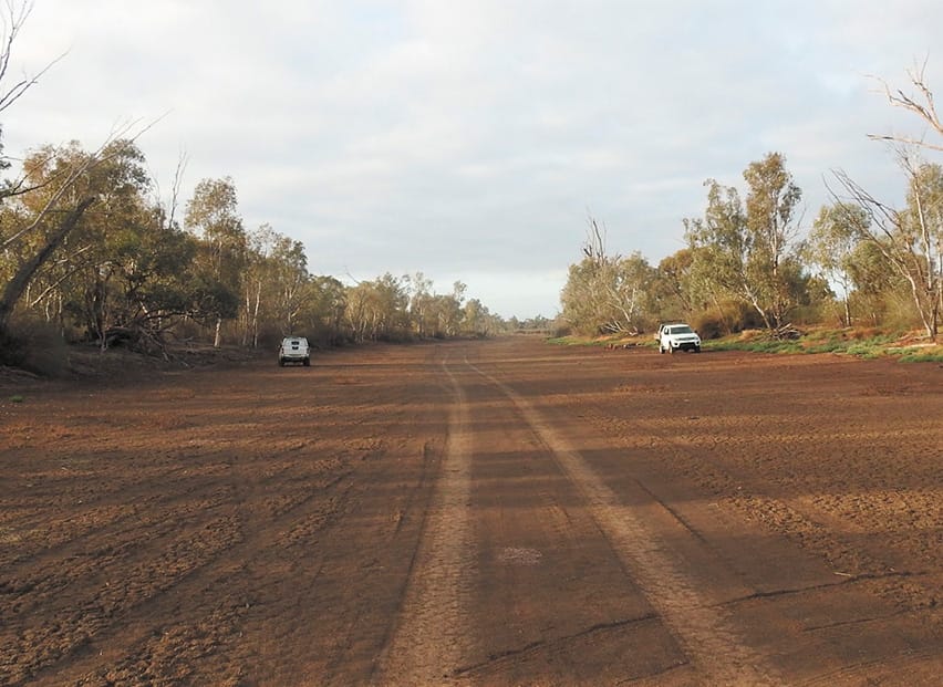
An area of great concern is the floodway itself. Identified by Gannawarra Shire and presented in their submission to the Victorian Government’s 2022 flood inquiry, the strategic clearing of waterways blockages was critical to prevent re-flooding agricultural land, private and public assets, infrastructure and homes.
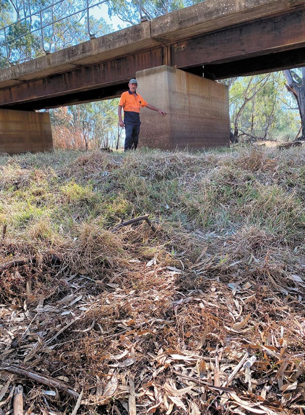
One area of grave concern to Kerang West residents is the Patchell Bridge downstream to below the railway bridge. The once sparsely covered floodway is now choked with lignum, silt banks and blockages of flood runners. Flood height data captured during 2022 clearing demonstrated that approximately 300mm of water head was held up, enough to raise the flood height from medium to high level flood risk, apply more pressure to the town bank, but also blowing out the Kerang West bank, flooding out Gannawarra residents’ homes.
Downstream also features another impediment to the flood movement, according to local Flood Warden Colin Myers, Sheepwash Weir. Originally a timber weir with gates to the bed of the creek, the failure of the old weir in 1974 saw a concrete structure installed with no opening at the creek floor height but a 1.6m wall of concrete.
“All the water is backing up because it has got to go over the top instead of going through and getting rid of it earlier.” said Colin.
“The Loddon peak used to beat the Murray, now we hold it all back and they arrive together. The Murray peak and the Loddon.”
Colin explained that the capacity of the Sheepwash Creek is 18,000 megalitres, but with the restrictive weir, the flow is forced to traverse the narrow lower Loddon. This means the water travels 50 kilometres down the lower Loddon rather than the 19 kilometres through the wide and open Sheepwash Creek anabranch.
When asked if the NCCMA would support the clearing of floodways to support lowering flood heights, an NCCMA spokesperson said, “The North Central CMA is yet to receive any formal application for the mentioned proposal.”
“If approved, CMAs will help to enable those activities in accordance with state and regional waterway floodplain and management strategies.”
This article appeared in The Koondrook and Barham Bridge Newspaper, 12 June 2025.
