
Natural Hazards Research Australia, Media Release, 14 May 2024
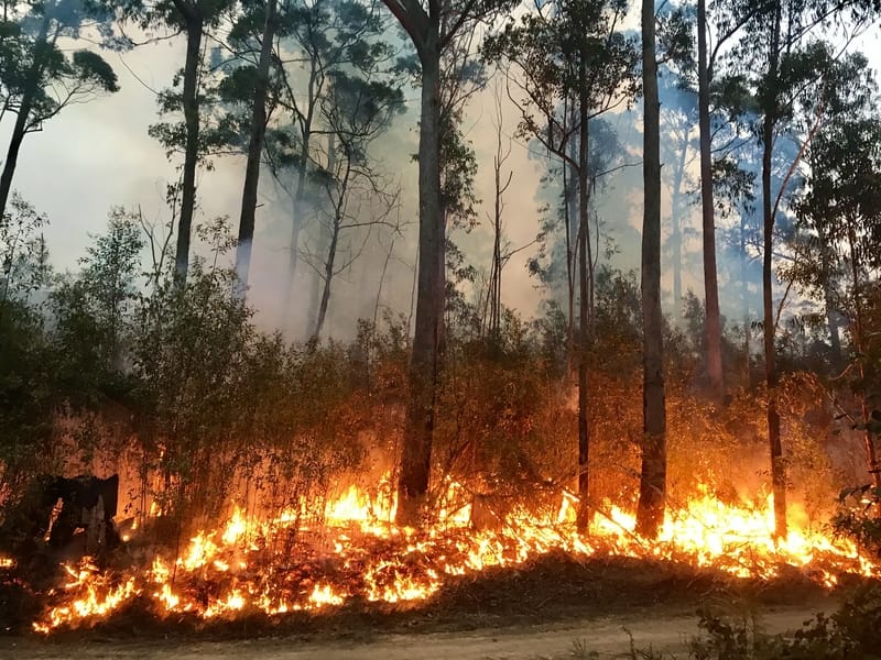
Michelago, Bredbo, Adaminaby and Jindabyne residents impacted by bushfires highlighted the importance of bushfire maps showing users their location in relation to a fire risk, while clearly communicating critical information such as direction of fire spread to ensure emergency information is easily understood and followed by communities under threat.
Findings from this research will be presented to researchers and emergency service representatives at the Natural Hazards Research Forum 2024 in Adelaide this week.
The research, conducted by Natural Hazards Research Australia, RMIT University, the Country Fire Authority (CFA) and the Victorian Department of Education, collated feedback from residents of Michelago, Bredbo, Adaminaby, Jindabyne and surrounds, Banks, Conder, Gordon and Tharwa in the ACT, as well as people in Tasmania (Huon Valley) and Victoria (Cardinia Shire) who experienced bushfire, to better understand how bushfire maps can better communicate risk during active bushfires.
Lead researcher, Dr Erica Kuligowski, Principal Research Fellow at RMIT University, believes that these research insights will help ensure appropriate predictive map design by emergency management agencies, significantly improving their understanding and use by people under threat, as well as better protecting against injury and loss of life.
“When bushfire maps help people understand their location in relation to the bushfire risk, as well as other important information including direction of the fire spread and the location of the fire front, they are empowered to make the best protective action decisions for themselves and their loved ones,” Dr Kuligowski says.
Bushfire and other real time weather and hazard tracking maps, including those created by local fire and emergency management agencies, the Bureau of Meteorology, Google or third-party weather or hazard mapping platforms, are a critical tool in communicating life-saving emergency information to people in the path of a bushfire.
The study found that most participants in the Snowy Monaro region and the ACT obtained information from fire agency apps and websites, including the Hazards Near Me app, ACT’s Emergency Services website, and the NSW Rural Fire Service website, while some monitoring the fire on the border between NSW and Victoria also used the VicEmergency app.
Supported by the NSW Rural Fire Service and the Snowy Monaro Regional Council, as well as the ACT Rural Fire Service, CFA and Tasmania Fire Service, the research found that community members in areas of risk generally wanted bushfire maps regardless of type to provide information that enables them to evacuate if safe to do so and routes are available; stay and defend; or follow actions specified in their household bushfire plan.
“Participants indicated the importance of maps communicating the direction of fire spread, as well as locations of fire activity so that they can understand the uncertainty and immediate and subsequent risk, enabling them to make informed decisions about when and how to avoid bushfire,” Dr Kuligowski says.
This information could also help residents understand fires’ behaviour and even identify possible routes out of the area.
Findings highlighted the strong use of bushfire maps by residents in bushfire affected areas as part of their overall emergency information sourcing, accessing maps up to 20- to 50-times per day during bushfires. They also stressed the importance of timely and date-stamped information.
“Participants found the inconsistencies between information sources due to different maps updating at different times, confusing – especially when the time of last update wasn’t included,” Dr Kuligowski says.
“This made it extremely challenging for participants who experienced these fires to clearly understand the risk being faced and act safely in a rapidly changing situation.”
The study also found that participants were more likely to trust the information expressed in bushfire maps if fire agency experts explained them in detail, such as at community meetings or face-to-face.
“Direct explanation of bushfire maps can improve residents’ understanding of and confidence in the information – helping reduce the possibility they will fill the gaps with their own knowledge and experience, which may not always lead to accurate conclusions,” says Dr Kuligowski.
The research identified challenges that people face in comprehending bushfire maps, including ways to correctly interpret locations of highest risk.
“The meaning of warning polygons, the triangle symbols and the meaning of their location, and the risks associated with certain areas of maps – the burnt areas or the areas of potential fire spread – could be barriers to correct interpretation of bushfire maps.”
“We also found that it was difficult for participants to identify the location of highest risk of harm, meaning additional work is required to ensure universal understanding of both incident and predictive maps,” Dr Kuligowski says.
“It is important to note that any bushfire map is ‘one tool in the box’ for community members at risk – sourcing information from multiple sources, such as community meetings and official warnings, is critical to gaining as detailed understanding of the risk as possible.”
These findings will inform further research now underway into the ways fire spread prediction maps can clearly communicate risk and uncertainty.
Related story: Input needed to improve bushfire maps in the ACT and Snowy Monaro
