
Natural Hazards Research Australia, Media Release, 7 March 2023
New research is exploring the vital role that bushfire maps play in informing how people respond to fire threats, with input from residents of southern Canberra, the southern ACT and the Snowy Monaro region of New South Wales impacted by any bushfire over the last four years needed.
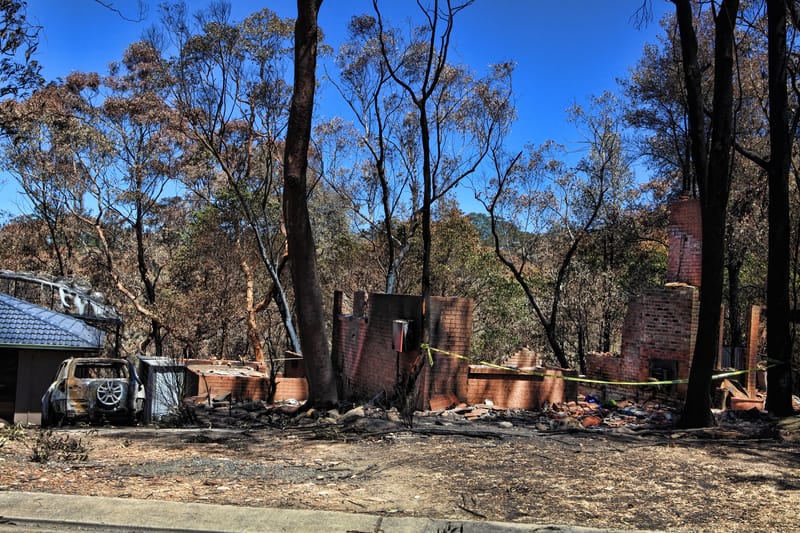
If you are a resident of Banks, Conder, Gordon or Tharwa in the ACT or Michelago, Bredbo, Adaminaby or Jindabyne and surrounds in New South Wales, have been affected by a bushfire and are aged 18 years or over, your experiences can help shape bushfire safety via a research interview in March.
The study by Natural Hazards Research Australia and RMIT University will help improve the design of maps used by fire agencies including the ACT Rural Fire Service and the NSW Rural Fire Service, that show a bushfire’s location and potential spread. The research is supported by the Snowy Monaro Regional Council.
No experience with bushfire spread prediction maps or maps in general is needed to participate. The research team will ask participants to recall information they received and actions they took during a previous bushfire, along with any role maps played in their response. Participants will also be asked for their perspectives on two pilot maps that have been developed for the study.
The research team will be conducting in”person interviews in Tharwa, Michelago, Bredbo, Adaminaby and Jindabyne from 16”25 March and registrations are encouraged now. Online interviews are also possible from 13 March, with residents of Banks, Conder and Gordon encouraged to participate in an online interview if they are unable to attend in”person in Tharwa.
To participate in either option register at https://bit.ly/3fnOChN and follow the prompts. Participants can also call or email the research team to express interest: (03) 9925 3267 or gita.pupedis2@rmit.edu.au
Dr Erica Kuligowski, Senior Research Fellow at RMIT University, said the input of ACT and Snowy Monaro locals will provide important information.
“To improve bushfire maps, we need to know what information people would expect to find on these maps,” Dr Kuligowski explained.
“This research will improve bushfire safety by finding out critical information about how both warning maps are understood, like those seen in Hazards Near Me now and previously Fires Near Me, as well as bushfire spread prediction maps, used and importantly, what actions those under bushfire threat would take after seeing these maps.
“If you want to have a say in how these maps are designed and communicated in future bushfires, please register for our research.
“This research will help bushfire safety, not just in the ACT and New South Wales, but around Australia, as we develop guidance for fire experts so that future bushfire maps can be better understood by the people who need them the most,” Dr Kuligowski said.
Research Registration – online at https://bit.ly/3fnOChN, call (03) 9925 3267 or email gita.pupedis2@rmit.edu.au
