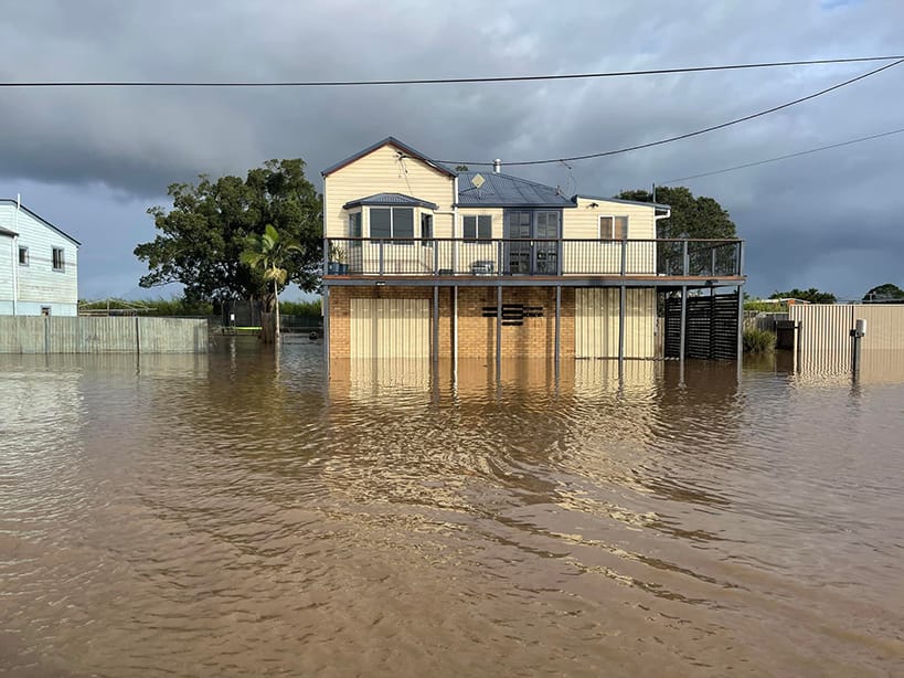
As the floodwaters receded, anger grew among residents about the scale of the March 1 flood.
Small towns such as Broadwater and Woodburn were destroyed.
Six weeks later, the smell and mud remain. There will be no quick recovery from this disaster.
Residents know about floods. They know how to prepare.
The March 1 flood blew them and their homes out of the water as the Richmond River rose way above what anyone had predicted or ever expected.
Flood questions
It has led some residents to question how and where the water was trapped and why it took longer to recede than previous floods.
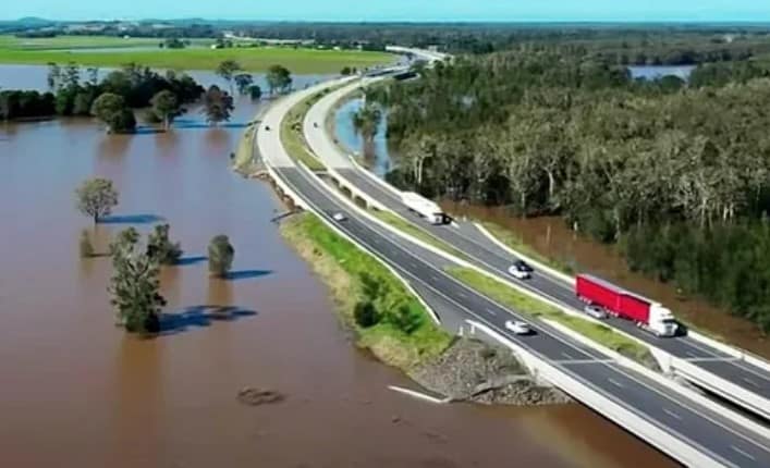
Some residents think it was simply the scale of the flood. Others though, are certain it has something to do with the newly built Pacific Highway creating a levy bank.
At a community meeting at the Woodburn Memorial Hall on Monday a group of residents made the decision to take action.
Class action against government
They are organising a class action against the State and Federal governments because of the impact the building of the Pacific Highway had on floodwater and their homes.
Litigator Nick Crouch has come out of retirement after one of his close friends in Woodburn lost everything in the floods.
With 7000 people affected by the flood directly and with 3000 unliveable homes, Nick and the group want to see people power pressure the government to act.
The politicians need to get their chequebooks out and help those affected by floods, Mr Crouch said.
“They have until April 30 to do that otherwise the next step is litigation.”
People power
The group Save Our River Towns needs 8000 registered voters to sign up by May 30.
With a block of 8000 votes across the seats of Richmond and Page, Mr Crouch said they will have the power to swing the vote.
“We have 17 days,” Mr Crouch said. “I want to collaborate with candidates to help all parties focus on the people who lost everything. A voting block helps the candidates define what the electorate want.”
The SORT group are seeking advice from an independent university hydrologist about the building of the highway and its impact on the landscape and how it drains after a flood.
If the politicians and the governments do not offer recompense, once the SORT group has a hydrologist report, they will take the next step.
The most important thing for the group is support through people power.
The group needs the registrations before postal voting for the election begins on May 8 for the Federal election day on May 21.
Farm cut in half by highway
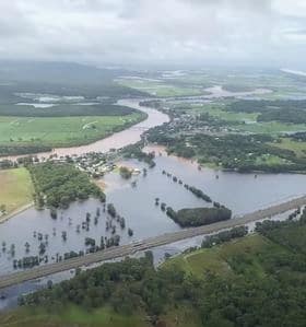
Photo: Contributed
Rebecca Vale said the new highway cut her father’s farm in half.
“He told them they are building in a flood plain. He wanted it to be a bridge through his property so cows and us could use both halves,” Ms Vale said.
“We have to go under the new highway and go through a few gates to get to back and it’s inaccessible to the cows.”
In the recent flood the water banked up against new highway and then slowly spilled over the top here, Ms Vale said.
“The water went higher than ever and lasted longer.
“Having lived it, seen it – it’s a dam.”
The highway didn’t cause the flood The rain is from the sky,” she said.
“The highway made the water sit for longer.”
Why didn’t they use pylons?
Rebecca Heywood said locals at Wardell who have been through the 1954 and 1974 floods know firsthand how the water used to flow.
“There are sections of floodplain south of the highway that were not affected. This water should have been able to get out to those areas and lessen the impact to a lot of homes,” Ms Heywood said.
“This highway has definitely impacted negatively on towns like Woodburn, Broadwater and Wardell both sides.”
Many residents suggested the highway across the floodplain should have been built on pylons.
“Like the part of the highway near Kempsey,” Ms Heywood said.
Kristy Elks said towns such as Wardell, Broadwater and Woodburn have fared well in previous floods because the water could get away downstream.
“This time the highway created a dam wall trapping the water in therefore flooding these towns and homes that have never been flooded in their entire history,” she said.
Transport for NSW response
A Transport for NSW spokesperson said the major flood event of February 28 was extremely rare with record river heights across many parts of the North Coast.
“The most recent rainfall fell on already saturated areas causing further inundation,” the spokesperson said.”¯
“While the project team is confident the flood models are highly reliable tools for flood management planning within the catchment, they are committed to understanding the recent flood events and how they interacted with the highway.
“This investigation is expected to take some time to complete.””¯
Transport for NSW is willing to set up a working group to review issues raised by local communities.
When the Pacific Highway was being rebuilt, the project team employed a qualified independent hydrologic expert whose appointment has been endorsed by the secretary of the Department of Planning and Environment to deal with all hydrological matters and assist landowners in negotiating feasible and reasonable mitigation measures.”¯”¯
Transport for NSW provided the NSW SES and local councils with information about their flood modelling process and the predicted flood behaviour associated with the upgraded highway.
“We have been assessing the Woolgoolga to Ballina Pacific Highway upgrade’s impact on flood behaviour since 2012.”
Sign up details
For more details on the class action, contact Nick Crouch on nick@crouch.com.au or phone 0411 274545.
To sign up as a registered voter to support flood impacted residents go to Save our River Towns
This article appeared on indyNR.com on 13 April 2022.
