
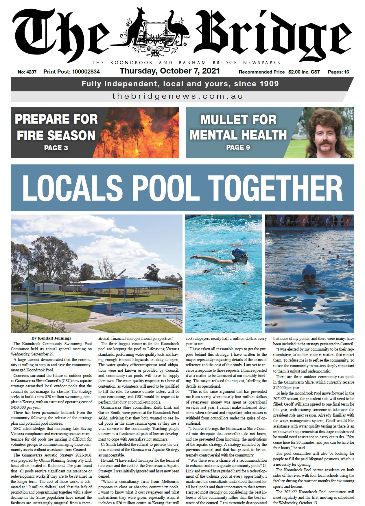
The Murray Regional Strategy Group (MRSG), which represents eight organisations across the NSW Murray, is conducting a monitoring program to clearly communicate the risks and benefits of water delivery through our region.
The delivery of water can bring with it amazing environmental benefits and also huge environmental risks and third-party impacts when not done in a balanced, nuanced, manner.
In order to help stop repeating the meaningless destruction that we have witnessed on the Murray, MRSG has developed the NSW Murray Valley Adaptive Road Map, which aims to deliver solutions to existing problems with water flows and management.
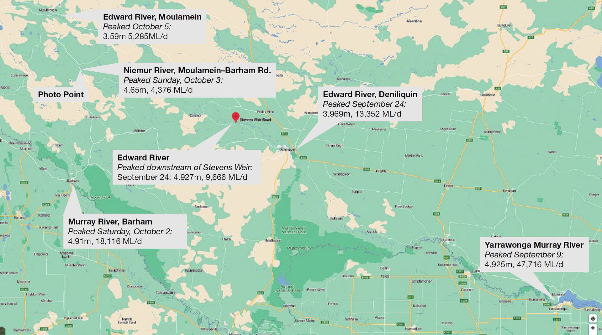
An initial part of the road map is the Mid-Murray Monitoring Project, of which stage one is complete. Under the project, MRSG is monitoring the ecological benefits from recent unregulated flow events, as well as the third party impacts to landholders.
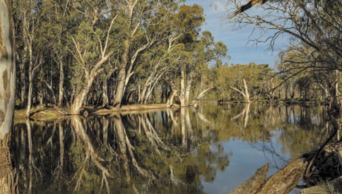
Photo: Lloyd Polkinghorne
MRSG chair Geoff Moar said it was important to understand how the river environment benefits from the increased flows that we have seen this year, compared to more recent dry years, adding this understanding can be achieved.
MRSG did apply to NSW Department of Primary Industries and Environment for $30,000 in funding to undertake this important project but the request was denied.
“Unfortunately, under the Basin Plan development and implementation, it is difficult for communities to have genuine input,” said Mr Moar.
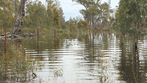
Photo: Lloyd Polkinghorne.
“We don’t have the financial resources for detailed studies that are an integral part of an adaptive plan, yet governments tend to fund academics but not community groups.
“We believe this is a fundamental flaw in the process that needs to be addressed,” Mr Moar said.
Mr Moar thanked the volunteer landholders who have provided valuable information to the monitoring project and the road map, as well as those from the scientific community who have assisted in a pro bono capacity because they want effective research that helps establish a sustainable pathway for our future.
“Volunteers have collaborated to collect data, and a local ecologist and expert in environmental flows has helped us prepare a report,” Mr Moar said.
“This work highlights the ecological benefits, as well as the third-party impacts, when there are flows between 25,000 and 30,000 megalitres a day from Yarrawonga.”
The monitoring program will also benefit from the larger secondary flow which peaked at 47,716 ML/d at Yarrawonga.
Mr Moar said MRSG would be inviting numerous government department and agency personnel to attend an online presentation of the report. He hopes this will help improve everyone’s understanding of river flows and the impacts – both beneficial and adverse – they can have on the environment and landholders.
Mr Moar said MRSG would continue trying to work with governments to develop water management solutions that provide a balance to protect the environment and ensure we have sustainable communities.
He added he hopes that once governments view and appreciate the extensive and professional work that has been done, they will be more willing to provide the funding needed to continue undertaking projects of this nature that have the potential to improve the way we use our most precious resource.
This article appeared in The Koondrook and Barham Bridge Newspaper, 7 October 2021.
