Somebody better tell mother nature to get with the program as Koondrook-Barham’s peak was exceeded seven days early.
The expected peak for Koondrook-Barham remains unchanged on official channels at an expected 6.2m. Mother nature had other ideas with a rainfall event on Monday, October 24 pushing the river to an eye watering 6.210m just one centimetre short of the highest recorded on NSW Water, the 1917 flood reaching 6.223m.
The premature peak caused a flurry of activity as crews sprang into action to fix leaking levees and to move on the rainfall that had accumulated in drains and around houses.
Both towns have been on high alert with a lot of preparation seeing sandbags delivered to lower parts of the levees on both sides. A wall of sandbags lines Grigg Road to keep Gunbower Creek water from cutting the main arterial.
Koondrook was aided by the Koondrook CFA, Gannawarra Shire Council staff, Koondrook Development Committee (KDC), members of the community and forestry. Barham was aided by the Barham Rural Fire Service, Murray River Council (MRC) staff, members of the community, and a plethora of SES, Marine Rescue, State Mitigation teams.
The monitoring of levees is being conducted by a roster system organised through KDC for Koondrook, and MRC levee monitoring is stepping up to a 24hr operation for Barham.
Police resources have also been called in from afar with Highway Patrol officers from Melbourne attending callouts in Koondrook.
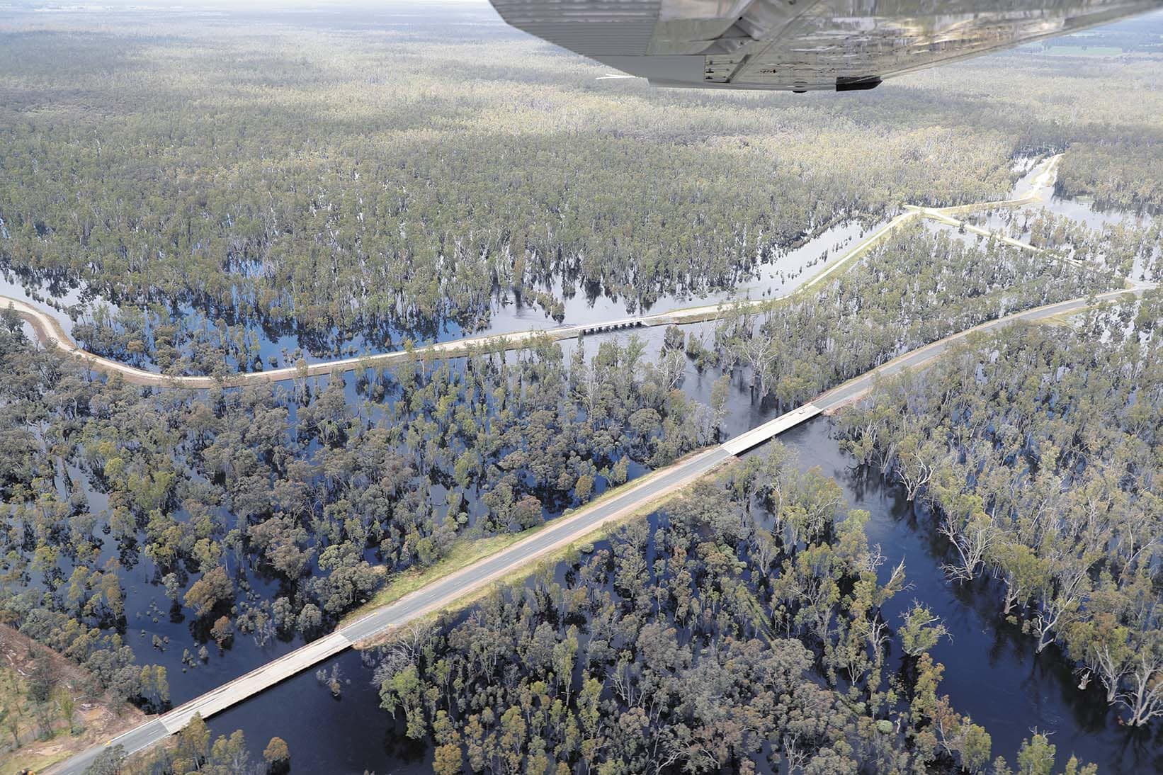
There has been much discussion over the lack of flows through the Koondrook and Perricoota Forests to the Moulamein Road. By Monday night, flows through the Barber, Cow and Calf Creeks had increased dramatically. By Tuesday afternoon, the flood marker on the levee bank at the Koondrook Forest had exceeded the 1993 and 1974 flood heights!
Travel around the district has been impacted with many road closures, these included the Kerang-Koondrook Road, Gonn Rd, Noorong Rd and Cohuna-Kerang Road. As road openings and closures is a time sensitive matter, please check with Vicroads for Victoria and for NSW, the Murray River Council Facebook page has been the most up to date.
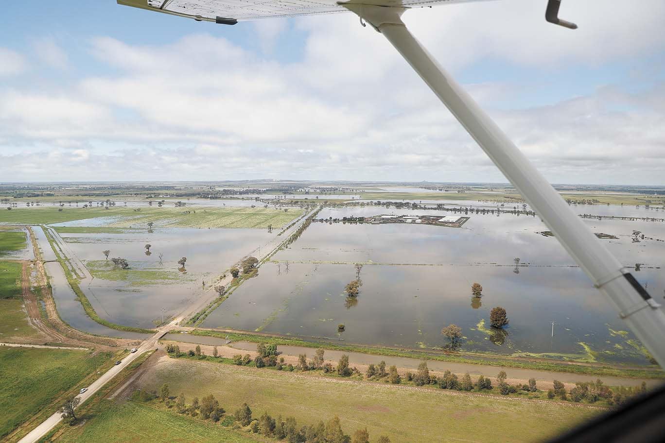
Farmers in the surrounding areas are feeling the pressure as once promising looking hay, pasture and grain crops are being impacted by not only flood water but also excessive rainfall. Rice farmers are being tested to the limits as mythical stories of rotary hoes being needed for paddock preparation leap from the pages of history to reality, others are abandoning pre-sowing fertiliser, moving a basic broadcasting seed before flooding, aiming to spread urea on a dried out established crop.
Stock producers have been working around the clock to ensure dry ground, secure feed and the best health of the animals.
If you’re rain dancing, I would please ask you to refrain for the time being!
At the time of printing, downstream of Yarrawonga, flows are 69,965ML/D, with local sites, the Murray River at Barham 36,100ML/D, the Edward River at Moulamein 13,229ML/D, the Niemur River at the Barham Road 20,126ML/D and the Wakool River at Barham Road 20,241ML/D.
This article appeared in The Koondrook and Barham Bridge Newspaper, 27 October 2022.
