Wayne Hawthorne, Naracoorte Community News
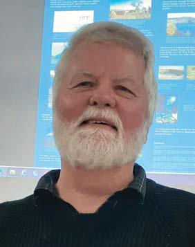
Caves aren’t just a hole in the ground it seems. Of interest is where they are, how they formed and why they exist. As important as “above ground” is to us, likewise what is below the surface is also of importance and worth knowing. Geology maps generally show what is on the surface, but much can be learnt from knowing what is below. Naracoorte Men’s Probus club learnt this from Ian Lewis, Australia’s only cave diving hydrogeologist. As a cave diver and geologist, Ian is the “eyes” underwater and underground for geologists as he looks at caves and their structure. He showed maps and diagrams to illustrate and develop his story.
Probarians were fascinated to learn specifically of the caves in the local Naracoorte area. Several of the Naracoorte Caves themselves are World Heritage listed and deserve wider appreciation. All caves in the area have been mapped for location and size. They do not appear at random, but fit a pattern based on their history and location.
Over 50 years of research, exploration and mapping by Ian and other cave explorers has revealed that Naracoorte Caves sit along the very long and ancient Kanawinka Fault Line, which extends from just north of Naracoorte to Portland/Cape Bridgewater, then possibly under-sea to western Tasmania. Movement within this fault line initiated the development of all the larger and deeper caves and has even diverted the direction of our three local creeks (Morambro, Naracoorte and Mosquito) over many thousands of years.
Running through the SE of SA are thirteen stranded ancient dune range coastlines, each formed about 80,000 years apart and getting younger going from Naracoorte to the modern coastline. These features are almost unique globally to here. They formed after 13 ice ages over the last million years. Sea water locked up as ice, dropping sea levels each time by up to 120m. On thawing, each time the sea never returned to previous levels on the land because the SE of Australia was ‘lifting up’ while the north was ‘pushing under’ the New Guinea mountains and causing the Indonesian volcanoes. The southern ‘lifting’ is also why the limestone cliffs of the Nullarbor Plains are visible today. In and around Naracoorte there are two ranges running through the town and region. The West Naracoorte Range runs right along the edge of the Riddoch highway, is 750,000 years old and sections through it are visible at the cuttings on McRae and Gordon streets and in Gartner’s Quarry near Comaum.
Then there is East Naracoorte Range which is 810,000 years old and seen at Henschke’s quarry and the World Heritage caves area. This range runs along the top of the Kanawinka Fault line for 50 kms over the border past Comaum. Further east of Naracoorte is the smaller Hynam Range which is probably a million years older than the East Naracoorte Range.
There are two types of caves of different ages and levels. When mapped the caves show a distinctive pattern. Small caves are shallower, older and more random in direction, whilst large caves are deeper, younger and their tunnels extend in an NNW direction. Smaller caves developed earlier than the last time the Kanawinka Fault Line moved about a million years ago. Larger caves are deeper and exist on the Kanawinka Fault Line but evolved after its last movement and because of it. Of interest is that the “Wet Cave” (ex “Tomato Stick Cave”) in the National Park is an example of where a small, shallower cave joins into a deeper, large cave due to an internal roof collapse many thousands of years ago. Caves mapped and explored as they were uncovered in Henschke’s quarry since the 1950’s show the same parallel and NNW tunnels as in deep caves. Cave explorers, fossil experts and geologists are very grateful to the Henschke family for the wide range of scientific cave discoveries made there with the willing support from the family for over 70 years.
Local caves around Naracoorte were shown and discussed, including Victoria Fossil Cave. In 1975, a cave at Jim Biggin’s near the pistol club had three pools of water that Ian dived in with SCUBA tanks. Water levels have now dropped 5-6m and those pools do not exist in the cave now. Sand Cave (near Robertsons Cave) at Struan has many low muddy tunnels, formed when Mosquito Creek once flowed further south than today and leaked into the cave, dissolving the soft limestone. One large cave in Henschke’s quarry was shown to be still naturally filled with rubble, which if removed or dissolved half a million years on would look like the Blanche cave.
The Kanawinka Fault Line last moved a million years ago, and only ‘bent’ the limestone layer upwards, rather than lift it and create a distinct wall or scarp. This bend was once observable in the walls in Henschke’s quarry. The Fault line is deemed to have had its time over the last 500 million years. It has lost its strength as Southern Australia does not have a large plate pushing against it to create movement, unlike the San Andreas fault line in California. Hence any further movement is now very unlikely.
Earthquakes were discussed in relation to Naracoorte. The largest earthquake in South Australia was near Beachport on 10 May 1897 and of magnitude 6.5 when buildings and nearby towns were severely damaged. On the day it happened, William Reddan who discovered Victoria Cave was underground there but reported later to worried friends that the work team felt no impacts at all. Another disturbance of magnitude 5.5 on 6 August 1948 was also centred beneath the sea about 10 miles north-west of Beachport, in much the same position as the centre of the 1897 earthquake. Less damage was reported from it.
Ground water and its contours were briefly discussed. An ancient hidden mountain range of granite exists running from Murray Bridge to Dorodong over the border and is known to geologists as the Padthaway Ridge but was almost covered millions of years later by the sea. The Granites, Mount Monster and Christmas Rocks are the visible mountain peaks of the buried granite. This hidden granite divide diverts ground water flows. Direction of flow is NW in the Upper SE and Mallee inland towards the Murray River gorge, and to the SW in the Mid- and Lower SE out to the coastline because of this underground granite divide.
The lateritic plateau between Casterton and Hamilton in W. Victoria was mentioned, as it is 100m higher than the SE of South Australia, and resists water erosion apart from where creeks flow. Lava flows in the Otway Basin were also mentioned, along with the Kanawinka Geopark and its poster of its historical geological development. Some stunning photos were shown of the Monbulla cave inside an ancient dune ridge where its sands in the walls have been ‘cemented’ naturally. Other photos showed stalactite straws and sediment below.
In all a fascinating geological story of the area, tailored to the Naracoorte area and its caves, with some great science to explain their existence and locations.
This article appeared in the Naracoorte Community News.


