Continued above-average daytime and overnight temperatures and below average rainfall for parts of central and south-east Australia are likely from February to April, according to the Bureau of Meteorology’s latest long-range forecast.
However, the bureau’s forecast also said there was likely to be above average rainfall in some parts of the east, but for much of the country, there’s no strong signal indicating wetter or drier than average conditions.
The bureau said for large parts of Australia, the rainfall forecast does not strongly favour any outcome, meaning there are roughly equal chances that February to April rainfall will be above, below or close to average.
“Rainfall is likely to be below average (60 to 75 per cent chance) for parts of southeastern, central and northern Australia.
“The drier than average forecast signal varies in strength and location from month to month as the season progresses.”
The bureau also said rainfall is likely to be above average (60 to 70 per cent chance) for parts of south-east Queensland and northeast New South Wales.
“February to April falls within the wet season for northern Australia when high-impact rainfall events regularly occur.
“There are increased chances of above average rainfall during March across parts of eastern Queensland.”
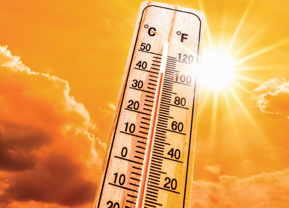
Minimum temperature are very likely to be above average.
The bureau’s forecast said maximum temperatures are likely to very likely to be above average (60 to over 80 per cent chance) across most of Australia.
“The chance of above average maximum temperatures is closer to 50 per cent across much of the north during March, reflecting the forecast for wetter conditions and increased cloud cover.
“Some areas have an increased chance of unusually high maximum temperatures¹ (over 50 per cent chance), including Tasmania, much of Western Australia, and parts of the east,” the bureau said.
“Minimum temperatures are very likely to be above average (more than 80 per cent chance) across most of Australia, with lower chances (closer to 50 per cent) across parts southern Australia.
“There is an increased chance of unusually high minimum temperatures (over 50 per cent chance) across much of northern and eastern Australia, with the strongest chances in the tropical north and parts of the east (over 70 per cent chance),” BOM said.
“Unusually high maximum and minimum temperatures are those in the warmest 20 per cent of February to April days and nights, respectively, between 1981 and 2018.”
The bureau said its long-range model, ACCESS-S, simulates how the atmosphere and oceans may change, using millions of observations from satellites, land stations, and ocean instruments. BOM also tracks global climate indicators to help understand longterm weather patterns. These mainly reflect how the ocean and atmosphere interact.
The bureau said sea surface temperatures (SSTs) in the Australian region were the third warmest on record for December. Global SSTs were the fourth warmest on record for December 2025.
“SSTs for the week ending 25 January 2026 show warmer than average waters off much of Western Australia and the northern NSW coast.
“Waters are cooler than average off the south-east Australian coast, and to Australia’s north,” BOM said.
“SSTs have cooled in recent weeks over the Coral Sea and Tasman Sea, with waters off eastern Queensland now close to average.”
The bureau said forecasts for February to April show warmer-than-average SSTs are likely across much of the Australian region, with notable warming predicted in the Tasman Sea.
“Warmer oceans can provide increased moisture and energy, that can enhance the severity of storms, cyclones and rain systems.”
The bureau said a weak La Niña continues in the tropical Pacific.
“The bureau’s model predicts that temperatures in the central tropical Pacific are likely to return to a neutral El Niño–Southern Oscillation (ENSO) state in late summer.
“This timing aligns with most international models assessed,” BOM said.
“The Indian Ocean Dipole (IOD) is neutral. The IOD is typically inactive from December to April.

This article appeared in Narrandera Argus, 5 February 2026.