
When Graeme Reid was out fixing fences with his son from Cameron Reid Fencing, he came across a striking burn mark on a survey tree.
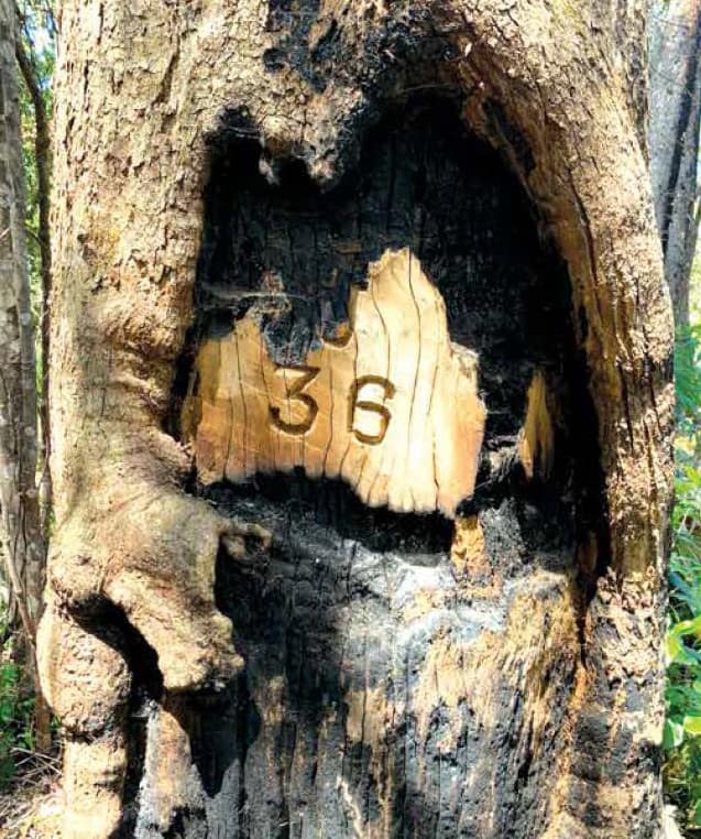
Photo: Graeme Reid
“I grabbed my el cheapo phone and took a photo.”
There were people from National Parks and Department of Primary Industries who wanted a copy of the unusual photo, Graeme said.
“It hits you in the eye straight away.”
The photo shows the number 36 – an old survey mark.
Fires last year burned a map of Australia around the chiselled mark, even including Tassie and what looks like New Zealand, Graeme said.
Graeme found the tree north of Mt Fargo and Mt Lindesay in the national park where he is helping to fix 28km of fencing on the Queensland border. It’s to stop Queensland cattle coming into NSW, he said.
Work has stopped now because the park is closed by wet weather.
Graeme lives on Graham Creek Rd, out of Woodenbong, and enjoy nature.
“I appreciate the rainforest and always look out for the birds.”

He never expected to find a map of Australia on a tree.
This article appeared in the Richmond River Independent, 20 January 2021.
